Abstract

Teaser image

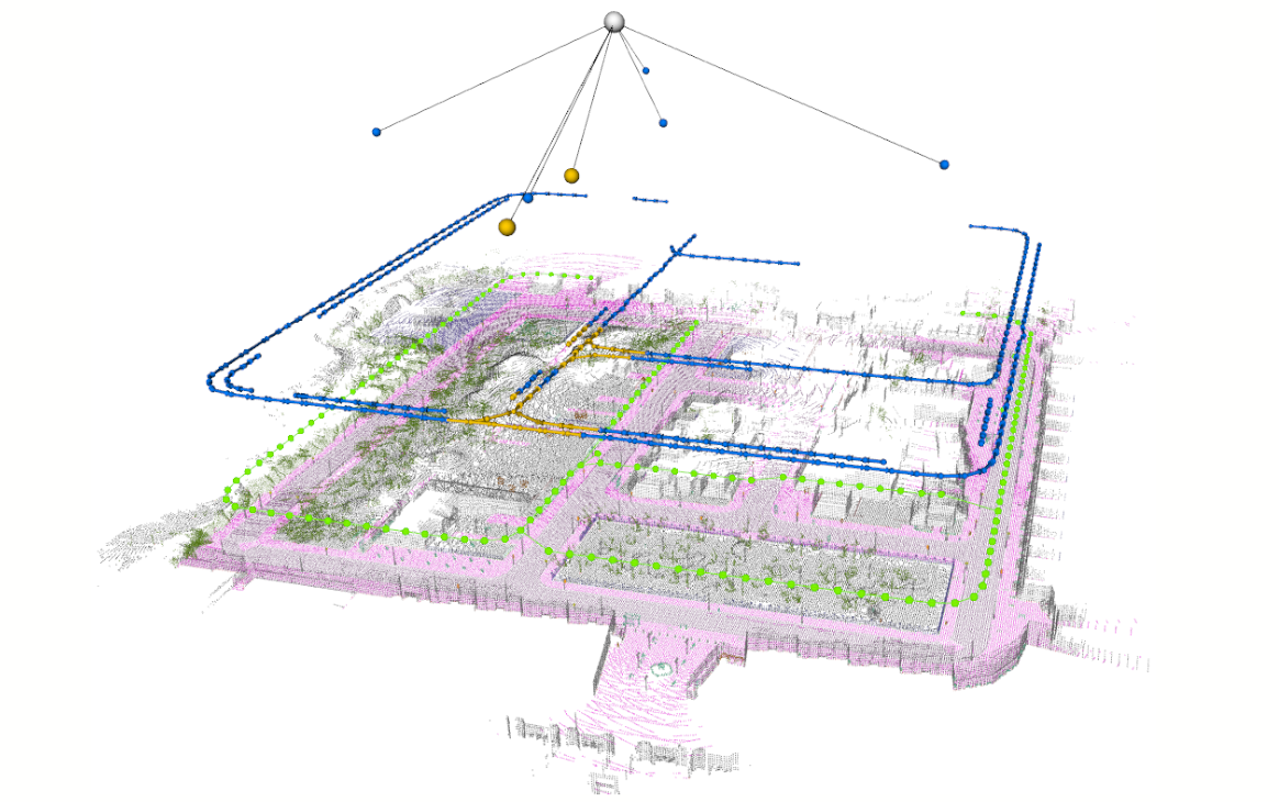
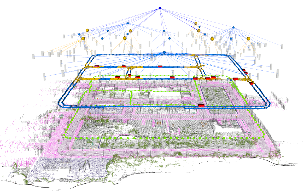
Maps have played an indispensable role in enabling safe and automated driving. Although there have been many advances on different fronts ranging from SLAM to semantics, building an actionable hierarchical semantic representation of urban dynamic scenes from multiple agents is still a challenging problem. In this work, we present collaborative urban scene graphs (CURB-SG) that enable higher-order reasoning and efficient querying for many functions of automated driving. CURB-SG leverages panoptic LiDAR data from multiple agents to build large-scale maps using an effective graph-based collaborative SLAM approach that detects inter-agent loop closures. To semantically decompose the obtained 3D map, we build a lane graph from the paths of ego agents and their panoptic observations of other vehicles. Based on the connectivity of the lane graph, we segregate the environment into intersecting and non-intersecting road areas. Subsequently, we construct a multi-layered scene graph that includes lane information, the position of static landmarks and their assignment to certain map sections, other vehicles observed by the ego agents, and the pose graph from SLAM including 3D panoptic point clouds. We extensively evaluate CURB-SG in urban scenarios using a photorealistic simulator and release our code.

Technical Approach

Overview of our approach

Overview of our proposed CURB-SG approach. Multiple agents obtain panoptically segmented LiDAR data and provide an odometry estimate based on the static parts of the point cloud. A centralized server instance then performs pose graph optimization (PGO) including inter-agent loop closure detection and edge contraction based on the agents’ inputs. Tightly coupled to the pose graph, we aggregate a lane graph from panoptic observations of other vehicles as well as the agent’s trajectories. Next, the lane graph is partitioned to retrieve a topological separation that allows for the hierarchical abstraction of larger environments. The resulting scene graph can then be used for further downstream tasks such as collaborative object detection or landmark-based localization.

Video

Code & Sample Data

A software implementation of this project based on PyTorch can be found in our GitHub repository for academic usage and is released under the GPLv3 license. For any commercial purpose, please contact the authors.

In addition, we provide sample data of CURB-SG in the form of rosbags for two distinct scenarios:

CURB-SG throughout exploration
CURB-SG throughout exploration: Multiple agents collaborate through a centralized instance to buid up a dynamic 3D scene graph of the environment. (Download)
Final result of CURB-SG
Final result of CURB-SG: The dynamic 3D scene graph contains lane information, the position of static landmarks, other vehicles observed by the ego agent, and the pose graph from SLAM including 3D panoptic point clouds. (Download)

Publications

If you find our work useful, please consider citing our paper:

Elias Greve, Martin Büchner, Niclas Vödisch, Wolfram Burgard, and Abhinav Valada
Collaborative Dynamic 3D Scene Graphs for Automated Driving
arXiv preprint arXiv:2309.06635, 2023.

(PDF) (BibTeX)

Authors

Elias Greve

Elias Greve

University of Freiburg

Martin Büchner

Martin Büchner

University of Freiburg

Niclas Vödisch

Niclas Vödisch

University of Freiburg

Wolfram Burgard

Wolfram Burgard

University of Technology Nuremberg

Abhinav Valada

Abhinav Valada

University of Freiburg

Acknowledgment

This work was funded by the European Union’s Horizon 2020 research and innovation program grant No 871449-OpenDR and the German Research Foundation (DFG) Emmy Noether Program grant No 468878300.